You’ve seen the movies. The sprawling Gatsby estates, the green light blinking across the water, the winding roads lined with stone walls that look like they’ve been there since the Revolution. But honestly, if you actually look at a map of the North Shore of Long Island, you start to realize that "The North Shore" isn't just one thing. It’s a messy, beautiful, jagged coastline that stretches from the edge of Queens all the way out to the tip of Orient Point. It’s a puzzle of glacial moraines and deep-water harbors that dictated exactly where the richest families in American history built their mansions.
Most people get it wrong. They think it's just a straight line.
It isn't.
If you trace the shoreline with your finger, you’ll see these deep "fingers" of water—Manhasset Bay, Hempstead Harbor, Oyster Bay, Huntington Bay—poking into the land. This geography is why the North Shore earned the nickname "The Gold Coast." Back in the early 1900s, the titans of industry didn't want to just be near the water; they wanted the privacy that these peninsulas provided. When you look at a detailed map, you're basically looking at a blueprint for 1920s social climbing.
The Geography of the "Fingers" and Why It Matters
Looking at a map of the North Shore of Long Island, the first thing that jumps out is the sheer complexity of the "necks." In Long Island parlance, a "neck" is basically a peninsula. You’ve got Great Neck, Little Neck, and Sands Point. These areas were formed about 20,000 years ago by the Wisconsin Glacier. When that massive ice sheet retreated, it dumped a pile of rocks and dirt—the terminal moraine—and carved out these deep, protected harbors.
This created a massive contrast with the South Shore. While the South Shore is flat, sandy, and shielded by barrier islands like Jones Beach or Fire Island, the North Shore is hilly. It’s rocky. It’s elevated. If you’re standing on a bluff in Wading River or Old Field, you might be 100 feet above the Long Island Sound.
That elevation is everything.
It meant that architects like Delano & Aldrich or Stanford White could perch massive limestone chateaus on hillsides with unobstructed views of the water. If you zoom in on a topographic map of the area near Mill Neck or Upper Brookville, you’ll see the contour lines are packed tight. This isn't the flat suburban sprawl people associate with Levittown. This is rugged terrain. It’s why the roads are so twisty. Ever tried driving 25A on a Friday afternoon? It’s a nightmare of curves and single lanes because you can’t easily pave a grid over glacial kettle holes and steep ridges.
The Great Gatsby Reality Check
Everyone wants to find West Egg and East Egg. If you look at the map of the North Shore of Long Island through the lens of F. Scott Fitzgerald, you’re looking at Great Neck (West Egg) and Sands Point (East Egg).
In the real world, the "Old Money" of Sands Point looked across the water at the "New Money" in Great Neck. Even today, you can see the difference in the plot sizes. Sands Point still has these massive, sprawling estates where you can barely see the neighbor’s chimney through the trees. Great Neck is denser, though still incredibly wealthy.
But here’s the thing: Gatsby’s world wasn't just two towns. It was a whole ecosystem. You had the Phipps family at Westbury House (now Old Westbury Gardens) and the Guggenheims at Falaise. When you map these out, you see they aren't just random. They follow the line of the Long Island Rail Road (LIRR). The "Main Line" allowed these bankers to commute into Manhattan while their wives and staff managed the country estates. If a town didn't have a direct train line, it didn't become a Gold Coast hub. Simple as that.
Navigating the Three Counties
The North Shore spans three distinct jurisdictions: Queens (NYC), Nassau, and Suffolk. Each has a totally different "vibe" on the map.
- The Queens Edge: This is where the North Shore begins. Think Douglaston and Bayside. You still get the hills and the water views, but you’re technically in New York City. The map shows a transition from the tight urban grid to the more winding paths of Douglas Manor.
- Nassau County (The Heart of the Gold Coast): This is the section from Great Neck to Oyster Bay. If you’re looking for the density of historic mansions, this is your zone. Places like Muttontown, Locust Valley, and Glen Cove define this area. Interestingly, many of these "villages" were incorporated specifically to keep developers out. They used the map as a weapon, zoning land so you needed at least two or five acres to build a single house.
- Suffolk County (The North Fork and Beyond): Once you cross the border into Lloyd Harbor and Cold Spring Harbor, things get woodier. The bluffs get higher. By the time you reach Port Jefferson and Mount Sinai, the "Gold Coast" feel starts to fade into something more maritime and rugged. Then, eventually, the map splits at Riverhead, and the North Shore becomes the North Fork—the land of vineyards and farm stands.
Honestly, the North Fork is like the North Shore’s chill younger brother. It lacks the pretension of the Nassau estates but keeps the incredible shoreline.
The Hidden Waterways
If you’re using a map of the North Shore of Long Island for boating, it’s a whole different ballgame. The Sound is notorious for its "fetch"—the distance wind travels over open water. Because the Sound is tucked between LI and Connecticut, it doesn't get the massive ocean swells of the South Shore, but it gets "choppy."
Look at the map near Huntington. You’ll see a complex series of nested harbors: Huntington Bay leads into Lloyd Harbor, which leads into Northport Bay. It’s a maritime maze. For a sailor in the 1800s, this was the safest place to be. For a modern kayaker, it’s a goldmine of bird watching and calm water.
The Logistics of 25A
You cannot talk about a map of this region without mentioning Route 25A. It’s the "Main Street" of the North Shore. Unlike the Long Island Expressway (the LIE), which is a straight, brutal scar across the center of the island, 25A follows the natural curves of the land.
It’s often called the Northern Boulevard or the North Shore Heritage Trail. If you follow it on a map, it takes you through the "bucket list" towns:
- Roslyn: A historic village tucked into a valley at the head of Hempstead Harbor.
- Oyster Bay: Home to Sagamore Hill, Theodore Roosevelt’s "Summer White House."
- Northport: A quintessential harbor town with a dock at the end of its main street.
- Stony Brook: Home to the university and a perfectly preserved "Federal style" village center.
The map shows 25A hugging the coast, but it often dips inland to avoid the steepest bluffs. It’s a slow road. If you’re in a rush, you take the Northern State Parkway. If you want to see why people pay $15,000 a year in property taxes, you take 25A.
What the Map Doesn't Tell You
Maps are great for boundaries, but they suck at explaining culture. For instance, a map of the North Shore of Long Island might show "Locust Valley," but it won't tell you about the "Locust Valley Lockjaw"—that specific, upper-class accent that’s mostly died out but still lingers in the halls of the Piping Rock Club.
It also doesn't show you the tension between public and private.
One of the most frustrating things about the North Shore map is that a lot of that beautiful coastline is inaccessible. You’ll see a massive green space on the map, think "Oh, a park!", and then realize it’s a private beach club or a gated estate. However, there are "hacks" for this.
Caumsett State Historic Park Preserve is the big one. It’s the former Marshall Field III estate. On a map, it looks like a massive thumb sticking out into the Sound. It’s over 1,500 acres. You can hike from the paved loops all the way down to a rocky, secluded beach. It’s one of the few places where the "Map of the North Shore" feels truly open to everyone.
Environmental Vulnerability
We have to talk about erosion. If you compare a map from 1950 to a map from 2026, the shoreline has changed. The North Shore is essentially a giant pile of loose glacial debris. It’s not solid rock like Manhattan.
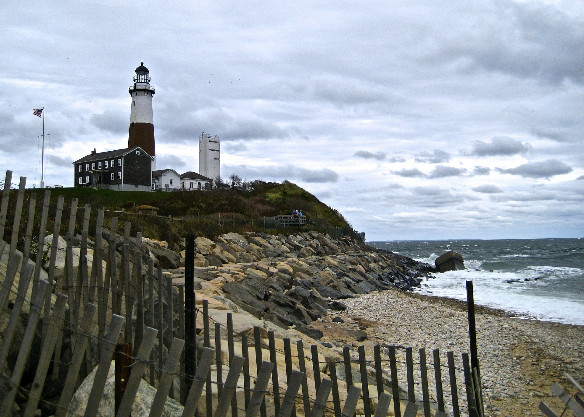
Every time a Nor'easter blows through, those high bluffs in Montauk or Miller Place lose a few inches—or a few feet. People build houses on the edge of the map, and then the map moves. It’s a constant battle of bulkheads and sea walls. When you're looking at property on the North Shore, "waterfront" often means "living on a disappearing cliff."
Actionable Insights for Navigating the North Shore
If you’re planning to explore or move to the area, don't just stare at a Google Maps screen. You need to understand the layers.
- Check the Elevations: Use a topographic layer. If you're buying a home, a "water view" on a map might mean you're 80 feet up a cliff with no way to actually get to the water.
- The 25A Rule: If you’re traveling East-West, 25A is for the scenery, the Northern State is for the speed (no trucks allowed), and the LIE is for the misery.
- Public Access Points: Look for the "Town" parks. In Nassau and Suffolk, many beaches are restricted to residents only. Find the State Parks—Sunken Meadow, Caumsett, Wildwood—if you aren't a local.
- The LIRR Divide: The Port Washington line is the only one that doesn't go through Jamaica station. It’s the "Gold Coast Express." If you’re looking at the map for commuting, that line is the "holy grail" of North Shore transit.
The map of the North Shore of Long Island is basically a story of how water and ice shaped the land, and then how money and power shaped the neighborhoods. It’s a place where you can find a 40-room mansion next to a 100-year-old clam shack. You just have to know which "neck" to turn down.
To get the most out of the region, start your journey at the Cold Spring Harbor Fish Hatchery for a sense of the local ecology, then drive north to Billy Joel’s motorcycle gallery in 20th Century Cycles in Huntington. From there, head to the Vanderbilt Museum in Centerport to see exactly how the "other half" lived when they owned the map.